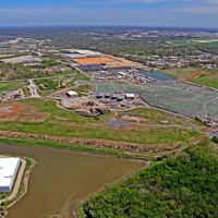
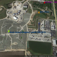
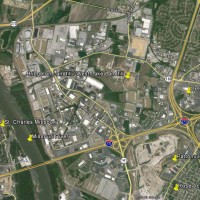
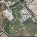
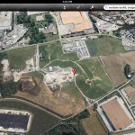
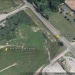
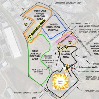
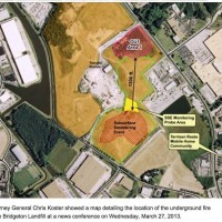
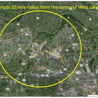
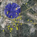
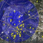
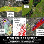
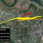
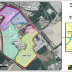
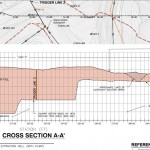
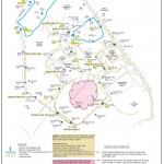
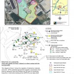
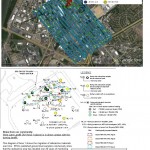
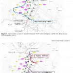
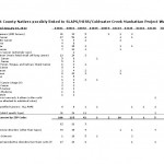
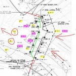
Maps Looking Northeast from Earth City toward Bridgeton. Photo by Bob Srenco. April 25, 2014 Bridgeton & West Lake Landfills – October 21, 2014 Aerial View of West Lake Landfill and Surrounding Areas – 2013 Google Earth – July 2013 West Lake Landfill Superfund Site – July 2013 Google Earth – April 2013 Detailed Layout of West Lake & Bridgeton Landfills Underground Fire Bridgeton Landfill – March 2013 10 Mile Evacuation Radius of West Lake Landfill 10 Mile Odor Radius of West Lake Landfill 3 Mile Odor Radius of West Lake Landfill What Could Go Wrong? Fire plus Natural Disasters! Close Proximity to West Lake Landfill Provided by Missouri Dept of Natural Resources Cross-Section Diagram of North Quarry OU-1 Area U235 Ratio and RA226, 228 with Udg Smoldering Event Supplemental Feasibility Study Showing OU-1 Area Growth Over Time SFS ASPECT and Area 1 Growth Over Time, v3 Location of Heat Front and Smoldering Event – 2012 North County Illnesses Linked to Manhattan Project Waste – January 2013 Gas Distribution System – North Quarry Basic Diagram on Spread of Radioactive Material